
What Is LIDAR And How Does It Affect Solar?
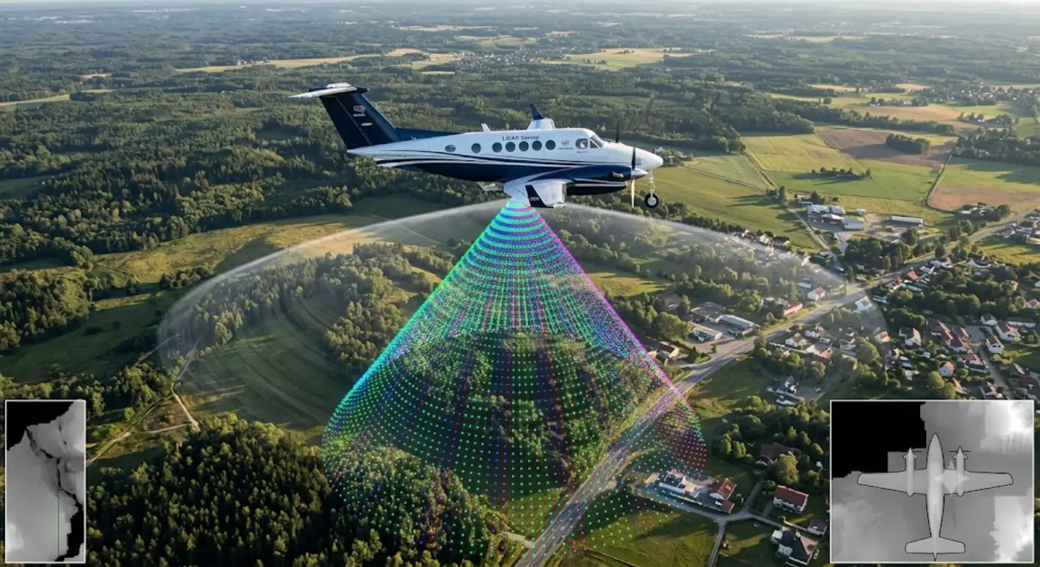
LIDAR (Light Detection and Ranging) is a remote sensing technology that uses pulsed lasers to measure distances and build precise, three-dimensional models of objects and environments. At Sunriver Solar, we use LIDAR data to calculate building heights, roof slopes, and tree heights. From this information we derive the amount of shade on each portion of your roof.
In the solar industry LIDAR has become one of the critical technologies installers rely on to generate accurate designs. In this blog we’re going to explain a bit more about how we use LIDAR to help make our design process more accurate, quicker, and easier.
LIDAR maps are created by flying over a particular area with airplanes and/or drones and measuring the heights of trees and structures. A three-dimensional model is created which we then input into our solar modelling software. The modelling software (we use Aurora Solar) uses the LIDAR information to calculate the shade on each portion of the roof. The shading information, along with many other factors, is then used to calculate the output of any given system.
LIDAR is very accurate. Survey grade scanners are known to be accurate within 3 mm. Cell phone scanners are accurate within 4 inches. The derived shading information is usually within 5% of the actual shade. Our practical experience with hundreds of installed systems is that our output estimates are more accurate than 5%. The software we use to model solar PV systems is very very good!
Further confirmation of the accuracy of LIDAR (and our modelling software) is that Wall Street investors rely on the same LIDAR information and modelling software that we use for individual residential rooftop systems. These investors invest hundreds of millions of dollars in utility scale solar PV systems, and they need to know with a high degree of confidence how much electricity their systems will produce.
When is LIDAR unreliable?
- If a homeowner has cut trees since the last LIDAR map was created.
- If a customer is building a new home
- If LIDAR is not available (Typically LIDAR is more available in urbanized areas and less available in rural areas).
In these cases, there are three solutions to the shading question.
- The first solution (the old school way) is that we go to the home with a Solmetric Suneye, and we physically measure the shade. The Suneye is a shade measuring tool, and it was the only way to measure shade before LIDAR. This requires that a technician climb on the roof and measure the shade at the location of the proposed array. We can then enter the Suneye information into the software model.
- If we have LIDAR but we know a tree or several trees have been removed, we can virtually delete those trees from the model. This will give us an updated and more accurate estimate of shade than the raw LIDAR data.
- For new homes that have yet to be built, we need to be a little more creative. We can look at the plans, model the home in our software, and estimate the size of the trees. Because we are making educated guesses, our accuracy in this case is generally less than the other cases.
Since LIDAR is such a huge part of our design process, and by extension the financial analysis of installing solar on a homeowner’s roof, we wanted to give you a look under the hood of how LIDAR is used.
If you have any questions about LIDAR or more generally about modelling, give us a call.
Phone
We are here 9 to 4:30 M-F and we answer our phones!
Working hours
| Monday | 9 AM–4:30 PM |
| Tuesday | 9 AM–4:30 PM |
| Wednesday | 9 AM–4:30 PM |
| Thursday | 9AM–4:30 PM |
| Friday | 9 AM–4:30 PM |
| Saturday | Closed |
| Sunday | Closed |
Our location
Social profiles